Mesh Network
Self-organizing mesh of 3 to 25+ AISAR nodes. TDOA/FDOA triangulation delivers meter-level geolocation. Self-healing topology with no single point of failure. Five nodes cover 25+ km².
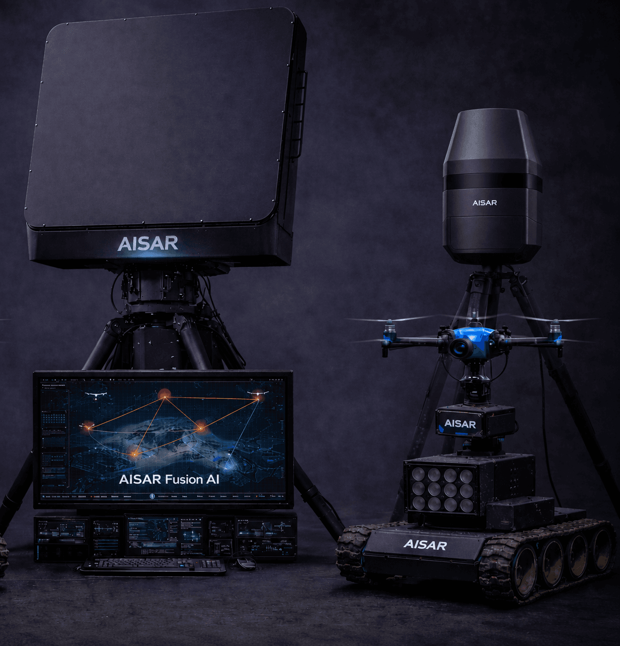
Six core capabilities
Each node captures the precise arrival time and frequency of a detected signal. The mesh engine correlates these measurements across nodes to triangulate the drone's 3D position. Even with two-node degradation the mesh continues tracking.
AISAR Mesh uses a distributed routing protocol — no central coordinator. If a node is damaged, jammed, or loses power, the remaining nodes automatically reroute and maintain coverage. No single point of failure.
Each node is a self-contained unit. Power on — it acquires GPS, joins the mesh, and is operational within 5 minutes. No pre-configuration, cabling, or RF survey required. Ideal for rapid force-protection deployments.
All nodes share a 1-pulse-per-second GPS timing reference. This provides nanosecond-level time synchronisation across the mesh without an external infrastructure — the key enabler for accurate TDOA resolution.
The mesh correlates signals at the track level — not just the detection level. Multiple simultaneous drone tracks are maintained independently. Swarm scenarios with 10+ cooperating UAVs are separated and tracked concurrently.
Mesh geolocation tracks feed directly into the CAPS Fusion Dashboard. Track data is correlated with CAPS optical and acoustic sensors for multi-modal confirmation and confidence scoring.
Scale from facility to national border
Scale coverage from a single facility to a national perimeter by adding nodes. Every configuration shares the same hardware and software stack — no re-integration required.
Minimum viable mesh. Triangle geometry provides TDOA baseline. Suitable for stadium-scale or single critical-infrastructure protection.
Recommended starting configuration. Five-node geometry provides redundancy and full 360° coverage. Self-healing survives a single node failure.
City-district scale coverage. Multiple overlapping baselines dramatically improve geolocation precision and ambiguity resolution in dense RF environments.
Large-area persistent surveillance. Nodes can be distributed asymmetrically to optimise coverage geometry. Centralized CAPS dashboard aggregates all tracks.
Passive RF Detection + Mesh.
Stronger together.
Each AISAR Mesh node is also an AISAR Detect passive RF unit. A 5-node mesh doesn't just geolocate — it simultaneously classifies the drone type at each node and cross-checks classifications across the mesh to improve accuracy in contested RF environments.
The result is a sensor network that detects, classifies, geolocates, and tracks — all without emitting a single RF photon.
LEARN ABOUT PASSIVE RF DETECTIONReady to cover your perimeter?
Talk to our team about the right node configuration for your site. We'll model your coverage geometry and show you the geolocation accuracy you can expect.